

Derbyshire - Peak District National Park
Visit the Peak District National Park
The very first of the National Parks, the Peak District National Park crosses the counties of Derbyshire, Yorkshire, Staffordshire, and Cheshire and is 555 square miles (1,438 square kilometers) in size.


The Peak District was the first region to be declared a National Park in 1951. Although the Lake District, Snowdonia, Dartmoor, Pembrokeshire Coast, North York Moors, Yorkshire Dales, Exmoor, Northumberland, and the Brecon Beacons had all been designated as National Parks by the decade's end.
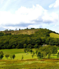
The Peak District National Park has a stunning array of scenery and paths to explore, from limestone dales with steep sides to dramatic high moorlands. It's probably best known as walking country. Whether you're looking for a leisurely stroll or a strenuous hike, there's a route to suit you.
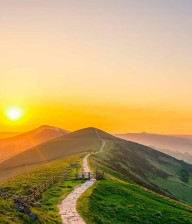
You can make use of the 524 square kilometres (202 square miles) of open access land or the 3,005 kilometres (1,867 miles) of public rights of way, or you can follow national or local trails. The Pennine Way National Trail is 431 kilometres (268 miles) long and traverses the rugged backbone of England from Edale to Kinder Scout. Kinder Scout is the Peak District's highest point at 636 metres (2,087 feet) and is an excellent challenge for experienced walkers.
The 4,023-kilometre (2,500-mile) Trans Pennine Trail is part of the E8 European Walking Route and connects the National Park to the Turkish border. (Although that's perhaps a little too strenous for a day trip!) The Limestone Way is 74 kilometres (46 miles) long and takes you through beautiful limestone scenery.
The Derwent Valley Legacy Way is 88 kilometres (55 miles) long and winds through a portion of the area's most extravagant scenery. you can find leaflets and route trails for these routes at local visitor centres, as well as the Ordnance Survey OL 24 White Peak and OL 1 Dark Peak maps, which show all the public rights of way and will be useful when you're planning your route.
You can walk the edges of the entire Peak District National Park by taking the Peak District Boundary Walk. Long-distance walkers will enjoy the challenge of walking all 188 miles in one go but the walk has also been broken up into stages so you can explore the Park boundary in manageable 'day trip' chunks.
The Pinnacle Way Walk is a 155-mile distance course that forms a circle through the Public Park - beginning and completing in Stockport, which has great public transport connections so you can do your bit to reduce your ecological impact on the landscape. The walk is intended to be completed in sections and includes moorland, villages, historic landmarks, limestone dales, gritstone edges, and lodging options.
The Monsal Trail, High Peak, and Tissington Trails in the White Peak region, as well as the Longdendale Trail in the Dark Peak region, all have paths that are suitable for wheelchairs or buggies. These routes make for easy, straight walks. The recreational areas of the Upper Derwent, Macclesfield Forest, and Goyt Valley offer additional walks that are suitable for everyone.
Cycling is a gentle way to improve your health and well-being, and - let's be honest - it's much more fun to ride on traffic-free trails through beautiful countryside than to pound the treadmill at your local gym.
There are loads of places where you can hire a bicycle if you haven't got your own wheels with you. At some centres, you can also rent more unnusual bikes, such as tricycles, hand-cranked bikes, electric bikes, mobility scooters, and wheelchair bikes. To share the burden, why not hire a tandem?
Location
Other Nearby Attractions
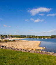
Derbyshire - Carsington Water
Derbyshire - Ashbourne Golf Club

Derbyshire - Cavendish Golf Club

Derbyshire - Higham Farm Fisheries

Derbyshire - The Monsal Trail
Derbyshire - Mam Tor Hiking Trails

Derbyshire - Bluebell Arboretum
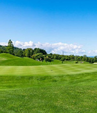
Derbyshire - Bakewell Golf Club

Derbyshire - Edale to Kinder Scout Circular Hike